
Page last updated or reviewed: Last updated May 22, 2024 (add 26 photos); created June 23, 2021
The $1.7 billion LBJ East project is rebuilding the freeway main lanes between IH 30 and US 75, and rebuilding the interchange at Interstate 30. The official web site, 635east.com, is regularly updated with high-quality aerial photos.

The LBJ east project is being built by Pegasus Link Constructors, which is a joint venture of Fluor Enterprises Inc. and Balfour Beatty Infrastructure Inc. This view looks east, from west of Greenville.
(Photo date: 18-May-2024)

High resolution
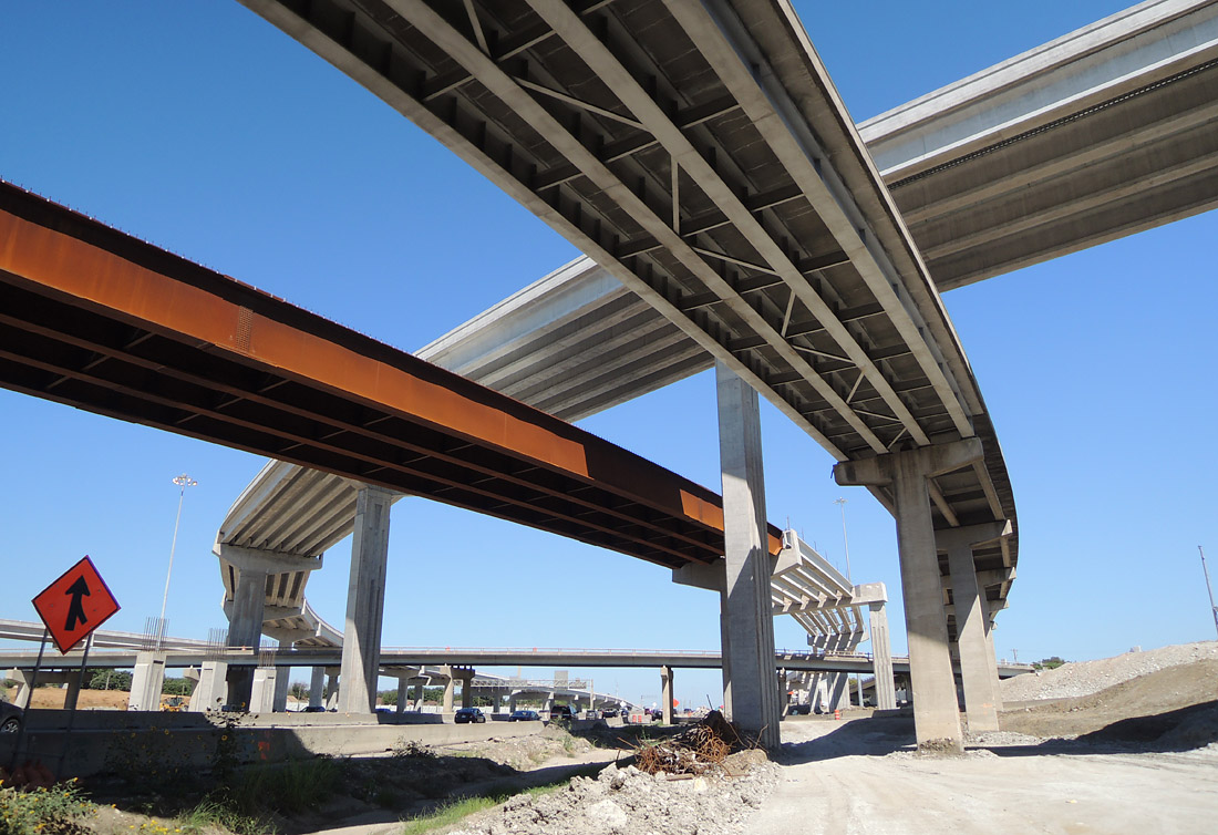
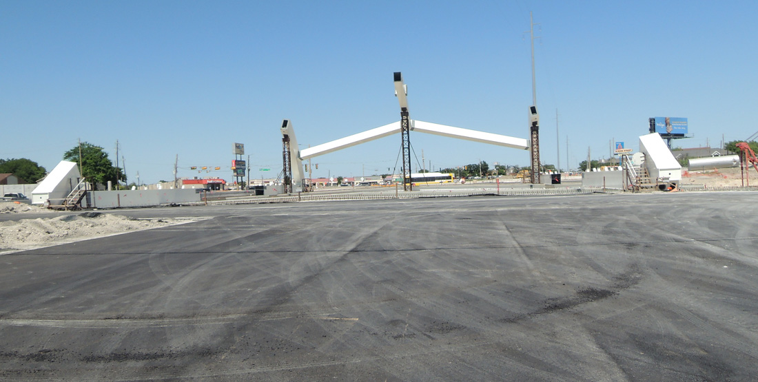
Looking north-northwest along LBJ Freeway at the Interstate 30 interchange. A temporary tower was in place for positioning of steel beams, which are visible on the left side of the photo.
(Photo date: 19-June-2021)

High resolution
A view of the beam placement scaffold.
(Photo date: 19-June-2021)

High resolution
Looking west along the eastbound IH-30 feeder road.
(Photo date: 19-June-2021)

Looking south at connection ramps for northbound IH-635
(Photo date: 19-June-2021)

High resolution
Looking southeast at the connection ramps for northbound IH-635
(Photo date: 19-June-2021)
High resolution
Driving northbound on LBJ Freeway.
(Photo date: 19-June-2021)

High resolution
Driving northbound on LBJ Freeway.
(Photo date: 19-June-2021)

High resolution
Looking east on the southwest side of the interchange.
(Photo date: 25-Sept-2021)

High resolution
Looking northeast in the center of the interchange. The steel beam across the top of the photo was placed since the previous photo above from June 19.
(Photo date: 25-Sept-2021)

High resolution
Looking south along Interstate 635.
(Photo date: 25-Sept-2021)

Looking south along Interstate 635.
(Photo date: 25-Sept-2021)
High resolution
Driving northbound on I-635
(Photo date: 25-Sept-2021)

High resolution
Driving northbound on I-635, on the north side of the interchange.
(Photo date: 25-Sept-2021)

High resolution
In March 2022, demolition of the original top-level connection ramps was in progress. This view looks northwest.
(Photo date: 20-March-2022)

High resolution
(Photo date: 20-March-2022)
High resolution
Looking north on the southeast side of the interchange.
(Photo date: 20-March-2022)

High resolution
(Photo date: 20-March-2022)
High resolution
(Photo date: 20-March-2022)

High resolution
(Photo date: 20-March-2022)

High resolution
(Photo date: 20-March-2022)

High resolution
(Photo date: 20-March-2022)

High resolution
Looking northbound along IH-635
(Photo date: 20-March-2022)

High resolution
The connector from northbound 635 to eastbound 30 is in the foreground.
(Photo date: 20-March-2022)
High resolution
(Photo date: 20-March-2022)

High resolution
(Photo date: 20-March-2022)

High resolution
This and the following images show the demolition of the 635 southbound to 30 eastbound connector.
(Photo date: 20-March-2022)
High resolution
(Photo date: 20-March-2022)

(Photo date: 20-March-2022)

(Photo date: 20-March-2022)

(Photo date: 20-March-2022)
High resolution
(Photo date: 20-March-2022)

(Photo date: 20-March-2022)

High resolution
(Photo date: 20-March-2022)

High resolution
(Photo date: 20-March-2022)

(Photo date: 20-March-2022)

This driver's view on the ramp from westbound 30 to southbound 635 shows the beams for the top-level ramps, with their concrete removed.
(Photo date: 20-March-2022)
High resolution
This view looks west on the southeast side of the interchange. The new (under contruction) WB-SB ramp is in the foreground. The existing WB-SB and EB-NB ramps were still in use at the time of this photo. The new EB-NB ramp, with beams in place, is visible in the background.
(Photo date: 18-Sept-2022)

This shows the original "double T" pylon at the center of the interchange. The original SB-EB and NB-WB ramps were on the top "T", visible between the new ramps. Due to the position of the new ramps, it was difficult to get a good view of the original pylon.
(Photo date: 18-Sept-2022)
High resolution
Looking northbound along I-635. To original EB-NB ramp, in the right-center, was still in use at the time of this photo. The new ramp is left center.
(Photo date: 18-Sept-2022)

High resolution
View showing the top level of the original central pylon, looking northwest.
(Photo date: 18-Sept-2022)

(Photo date: 18-Sept-2022)

(Photo date: 18-Sept-2022)

High resolution
Driver's view going westbound on Interstate 30'
(Photo date: 18-Sept-2022)

High resolution
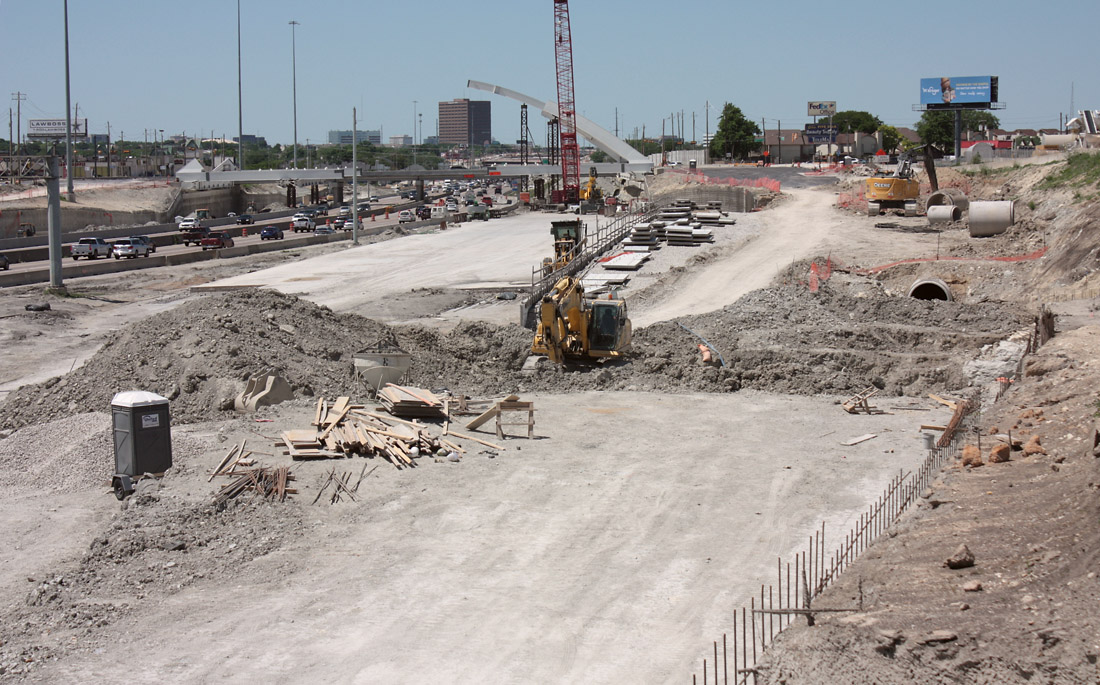
In April 2023 work was in progress on the single-span arched crossing at Skillman. This is a driver's view going northwest.
(Photo date: 16-April-2023)
High resolution
Looking northwest toward Skillman from the pedestrian crossing at the DART station.
(Photo date: 16-April-2023)
High resolution
Looking northwest on the south side of Skillman
(Photo date: 16-April-2023)
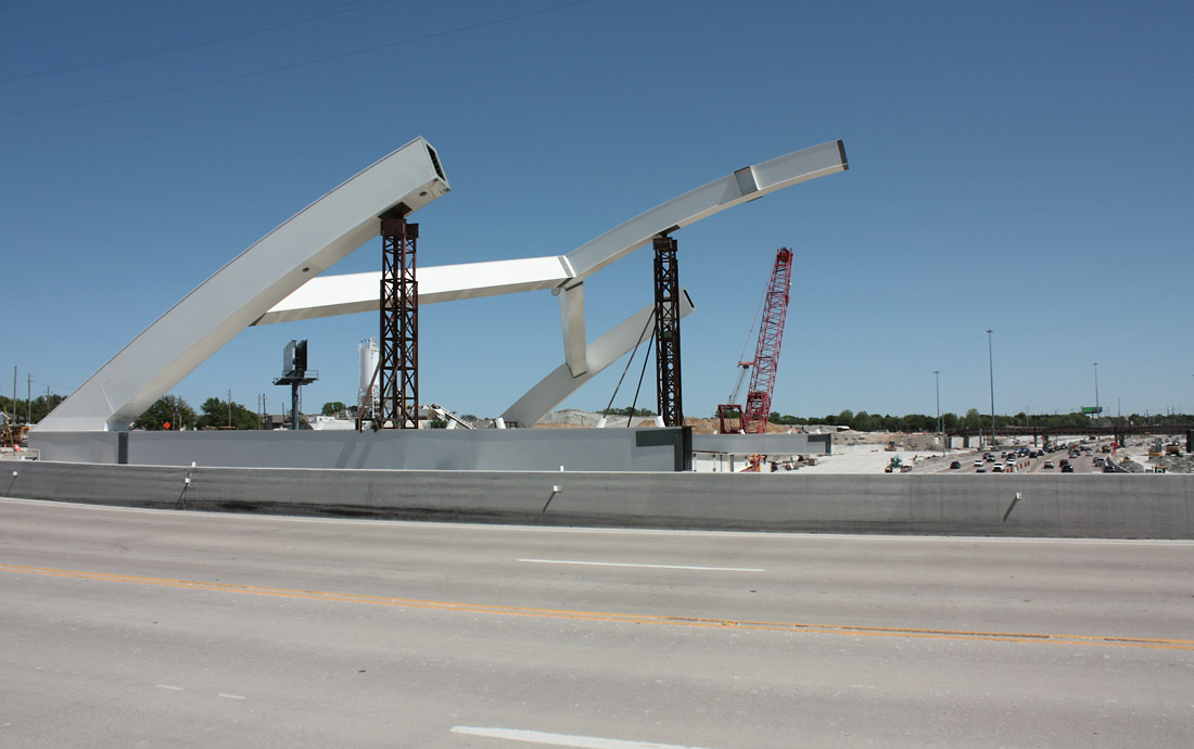
A temporary crossing was built on the west side of the new Skillman bridge. This view shows the steel arch structure for the new bridge.
(Photo date: 16-April-2023)
This view looks northeast along Skillman, on the south side of the freeway, showing the arch construction in progress.
(Photo date: 16-April-2023)

High resolution
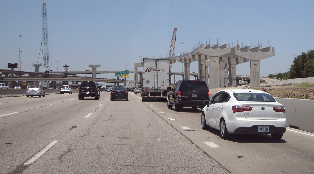
This view looks north at Oates Road.
(Photo date: 16-April-2023)

High resolution
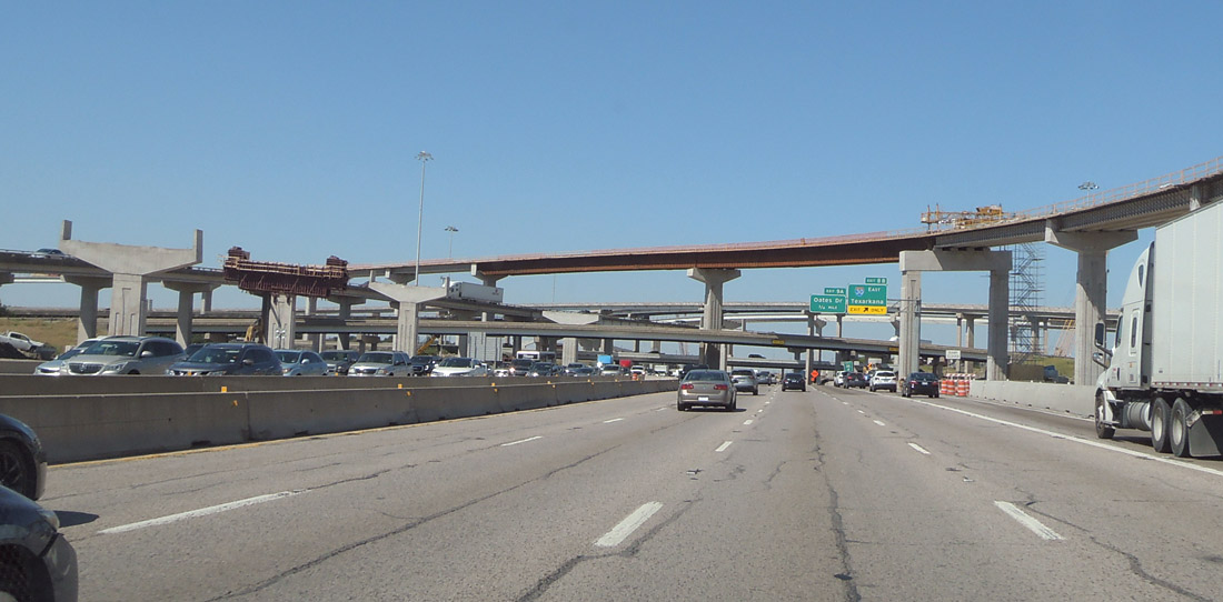
This view looks northeast at the center of the interchange at LBJ and I-30. As of April 2023, only two original ramps remained in service, and are shown in this photo. (The ramps with arched steel beams are original.)
(Photo date: 16-April-2023)

Looking east on the southwest side of the interchange.
(Photo date: 16-April-2023)

High resolution
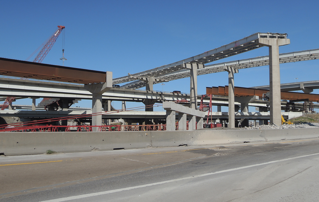
In May 2024, all original ramps were removed. The orginal central double-T pylon remained standing in the center of the interchange. This view looks northeast.
(Photo date: 18-May-2024)

High resolution
Looking northeast.
(Photo date: 18-May-2024)

Looking northeast.
(Photo date: 18-May-2024)

High resolution
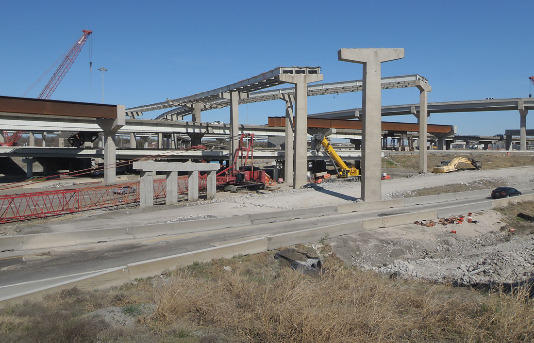
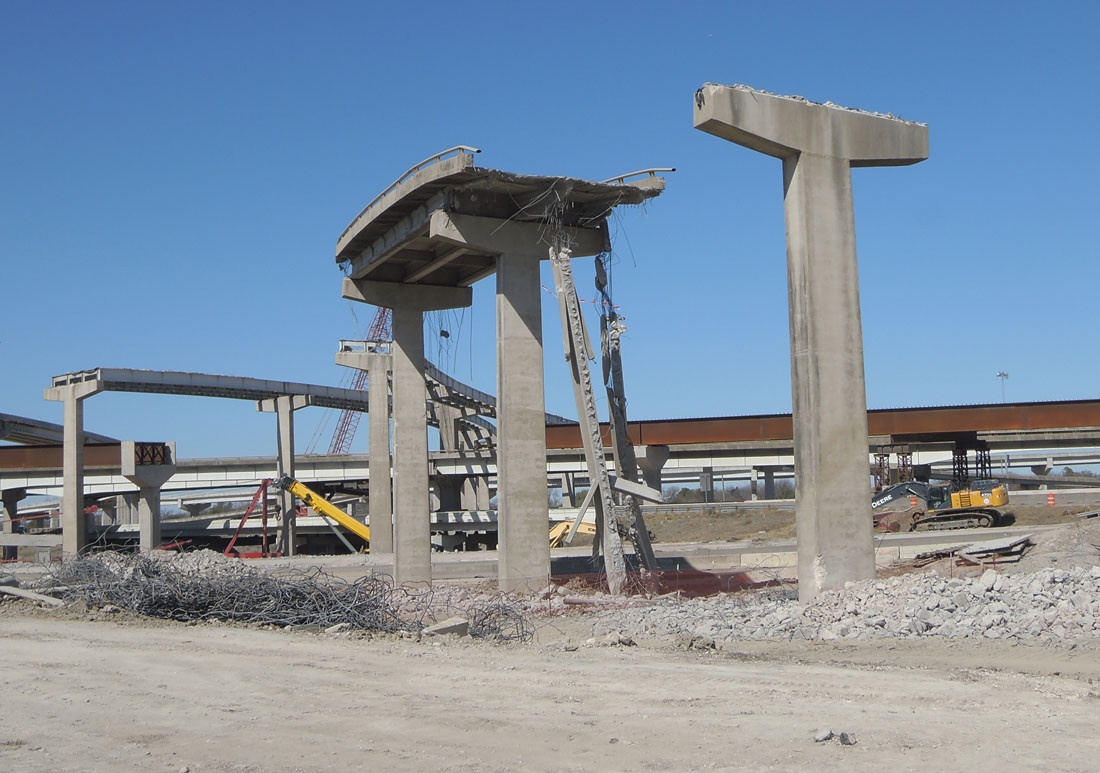
In May 2024, only two piers remained from the original connection ramps. Both are visible in this photo, the pier in the foreground and the central double-T pylon.
(Photo date: 18-May-2024)

High resolution
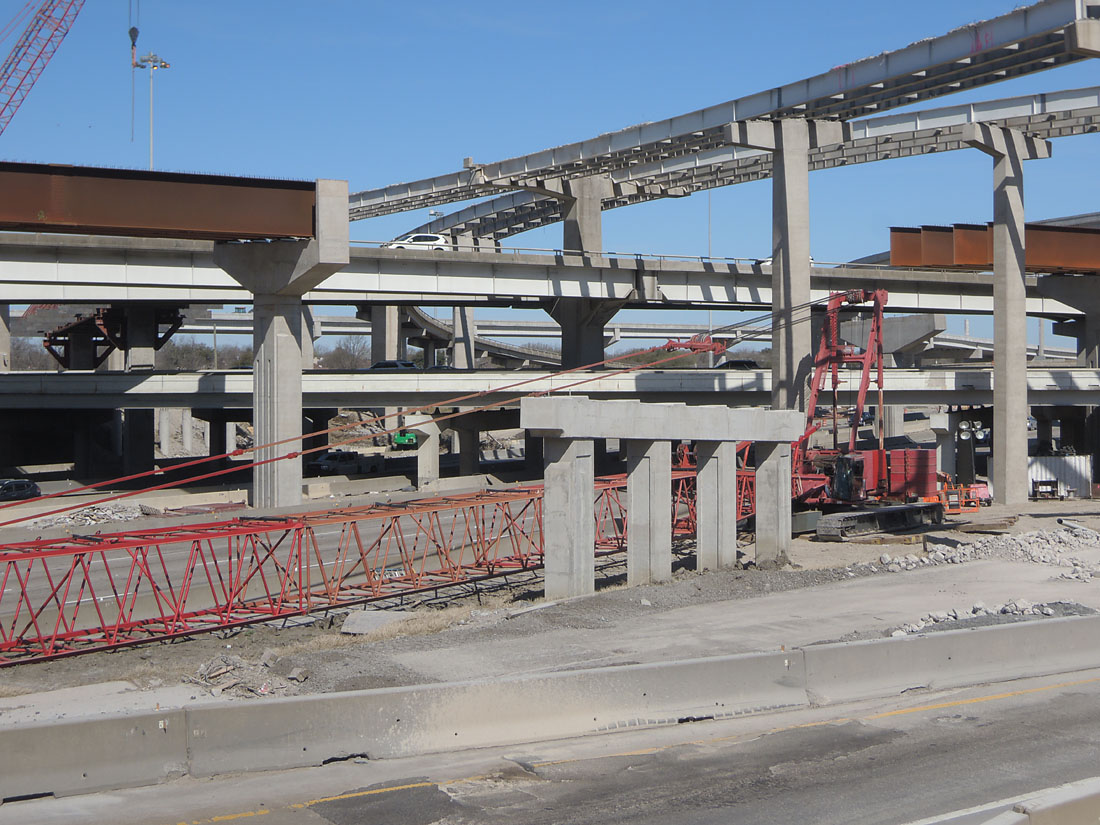
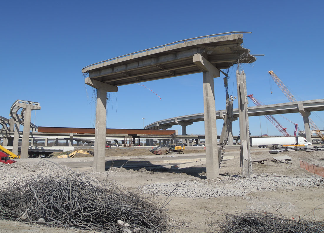
Looking southwest across the interchange, showing the original central double-T pylon.
(Photo date: 18-May-2024)

High resolution
Looking southwest
(Photo date: 18-May-2024)

Driver's view going northbound on I-635, showing the orginal central double-T pylon.
(Photo date: 18-May-2024)

Driver's view going northbound on I-635
(Photo date: 18-May-2024)

High resolution
Looking north from Oates Drive
(Photo date: 18-May-2024)

High resolution
Looking north from Oates Drive
(Photo date: 18-May-2024)

Driving's view looking northwest approaching Jupiter.
(Photo date: 18-May-2024)

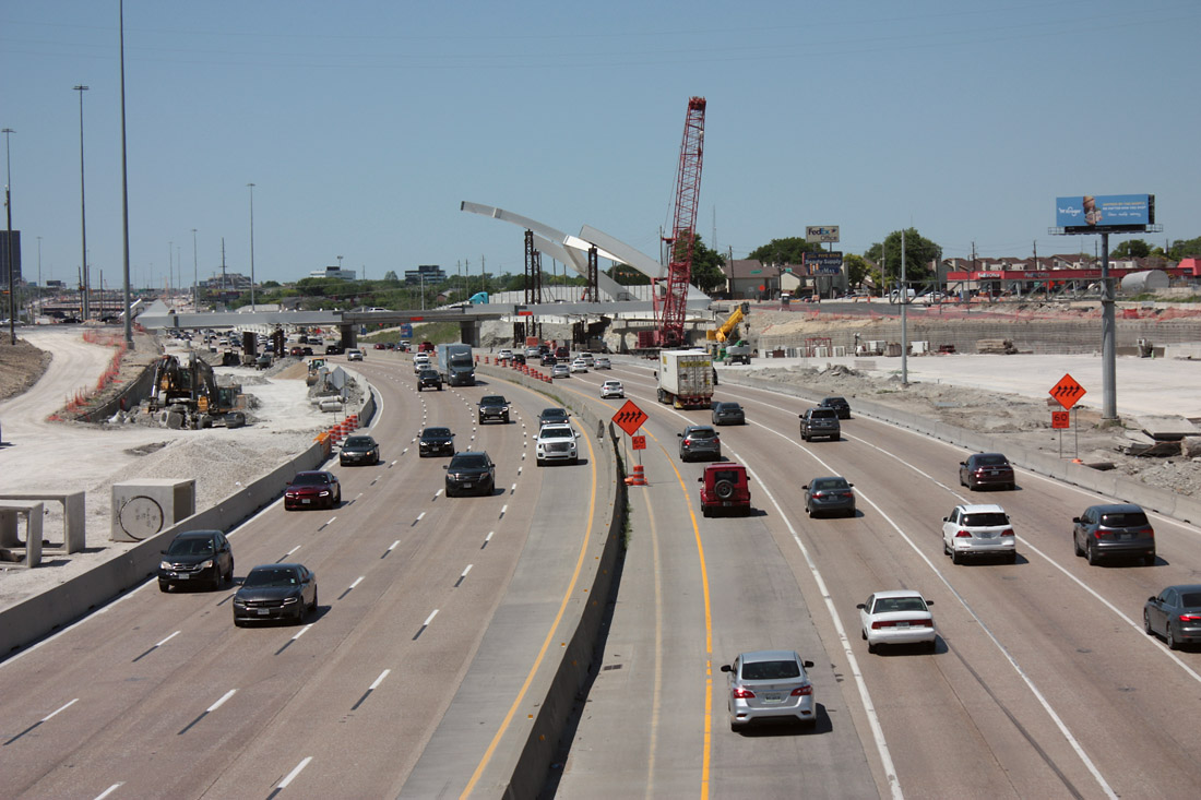
Driver's view going northwest at Plano Road. Traffic is on the new pavement. This is the first substantial use of new pavement. The traffic switch had occurred recently before this photo was taken on May 18, 2024.
(Photo date: 18-May-2024)

Traffic shifts from the new pavment to the original pavement at Miller Road.
(Photo date: 18-May-2024)

Driver's view at Skillman/Audelia. The structure for the arched bridge was complete on the photo date of May 18, 2024. However, it was not open to traffic.
(Photo date: 18-May-2024)

Driver's view, exiting to Forest Lane.
(Photo date: 18-May-2024)

High resolution
Looking northwest from the Audelia/Skillman overpass.
(Photo date: 18-May-2024)

High resolution
Looking northwest from the Audelia/Skillman overpass.
(Photo date: 18-May-2024)

High resolution
Looking northwest from the Audelia/Skillman overpass.
(Photo date: 18-May-2024)

High resolution
Looking northwest toward the Audelia/Skillman bridge.
(Photo date: 18-May-2024)

High resolution
Looking northwest toward the Audelia/Skillman bridge.
(Photo date: 18-May-2024)

Looking east from west of Greenville.
(Photo date: 18-May-2024)

Looking southeast from the Greenville overpass.
(Photo date: 18-May-2024)

High resolution
Looking southeast from the Greenville overpass.
(Photo date: 18-May-2024)

Looking southeast from the Greenville overpass.
(Photo date: 18-May-2024)

Driver's view on the entrance ramp going west from Greenville.
(Photo date: 18-May-2024)

Driver's view on the entrance ramp going west from Greenville.
(Photo date: 18-May-2024)